Brazil
Brazil has announced an intention to reduce its GHG emissions by 37% below 2005 levels in 2025, and by 43% by 2030. To do so, Brazil acknowledges in its NDC, the important role of local governments and their contribution to tackling climate change. You can download Brazil’s latest NDC here.
The Urban-LEDS project Phase I was implemented in Brazil, with a total of eight cities participating. Two Model cities and six Satellite cities received support to develop Low Emission Development Strategies, GHG emissions inventories, climate commitments, and to implement a variety of low emission development solutions. Key achievements are outlined below. During Phase I of the Project, discussions on vertical integration and support for local climate action was discussed with various ministries, as was the use of the GCC methodology for other cities in the country. Officials from the Ministry of Cities reviewed an innovative Urban-LEDS/ISOCARP proposal for low emission development zoning in a model city.
In Phase II of the Urban-LEDS project, participating cities will be supported in a review of the progress they have made towards low emission development, with a focus on developing project proposals and seeking funding to implement the action plans developed in Phase I. Where needed, data will be updated, including greenhouse gas inventories and climate change vulnerability risk assessments.
Led by: ICLEI South America Secretariat.
Supported by: UN-Habitat Regional Office for Latin America and the Caribbean
About Brazil
The National Project Advisory Group (PAG) in Brazil is composed of the Ministry of Environment (BR), Ministry of Foreign Affairs of Brazil, ANAMMA (National Association of Municipalities) (BR), São Paulo Municipal Committee for Climate Change and Eco-economy (BR), Environment Secretariat of the State of São Paulo (BR), Adjunct Secretary of Green and Environment of the Municipality of São Paulo (BR), Environmental Company of the State of São Paulo (CETESB) (BR), Environment Secretariat of Santos (BR), Fiji Ambassador to Brazil, FIESP (Federation of Industries of the State of São Paulo) (BR), Brazilian Forum on Climate Change (FBMC), WRI Brazil, Climate Observatory (OC) (BR), WWF Brazil, SOS Mata Atlântica Foundation (BR), Intermunicipal Consortium of the West Region (CIOESTE), Company of the Metropolitan Region of São Paulo (BR), Green Party (BR), São Paulo State Department of Logistcs and Transportation (SLT) (BR), Renewable Energies of the State of São Paulo (BR), CETESB (BR), and the European Union Delegation to Brazil.
Contact us
ICLEI South America Secretariat
Rua Marquês de Itu 70 – 14th floor, Vila Buarque.
Postal Code: 01223-000, São Paulo – SP, Brazil
Phone: +55 11 50843079
E-mail: [email protected]
UN-Habitat Regional Office for Latin America and the Caribbean
Rua Rumania 20 Rio de Janeiro RJ CEP 22240-140
Tel: +55 21 3235 8550
E-mail: [email protected]
Results from Phase I
The national project launch took place at the Second Meeting of Cities with Sustainable Development, organized by the Brazilian National Front of Mayors in Brasilia, in April 2013. The first agreements were signed by the city mayors at this meeting in the presence of Brazilian President Dilma Rousseff and several Ministers of State, including mayors from the Brazilian Model Cities of Fortaleza and Recife, and the Satellite Cities of Belo Horizonte, Porto Alegre, Rio de Janeiro, Curitiba, Sorocaba and Betim.
As Urban-LEDS Phase I finished in 2015, Brazilian cities had achieved the following:
- Recife: In April 2014 Recife’s Municipal Council approved the Municipal Climate Change and Sustainability Bill (Law N°18.011/2014) – which will be the basis of the city’s future LEDS. This law also required the City to prepare a sustainability certification scheme (based on Belo Horizonte’s example). In November 2015, the Decree, N° 29.219 enacting the City’s Action Plan and Target was approved by the Council.
- Fortaleza: In December 2015 the Mayor signed the Climate Change Bill, which includes the city’s Urban LEDS policy, commitments and actions.
- All eight Brazilian cities are reporting in the carbonn® Climate Registry (cCR). You can visit their profiles in the city pages.
- All eight Brazilian cities have implemented a range of low emission development solutions with the help of Urban-LEDS, including: installation of photovoltaic (PV) panels, building recycled infrastructure, setting up awareness-raising centers, and developing an LED street lighting project. To read more about these solutions, download the final Urban-LEDS report or visit the city pages.
Model cities
Fortaleza
Recife
Satellite cities
Belo Horizonte
Betim
Curitiba
Porto Alegre
Rio de Janeiro
Sorocaba
See tabs below for city profiles.

Fortaleza is the capital of Ceará State, Brazil. The city was founded on April 13th, 1726. It is now the 5th most populous city in Brazil. Fortaleza was a model city in Phase I of the Urban-LEDS project.
The environment of Fortaleza has characteristics similar to those that occur all along the coast of Brazil. The climate is hot and tropical. The predominant vegetation is of mangrove and restinga with the Ecological Park of Cocó as the main green space in the city. Its elevation has an average altitude of fifteen meters and the biggest river is the Cocó. The institution that has the ability to promote and execute municipal environmental policy is the Municipal Secretariat of Environment and Urban Control (SEMAM).
| Size of population (year) | 2,452,185 (2010, IBGE) |
| Size (km2) | 314.930 km² (2017, IBGE) |
| Population density (year) | 7,786.44 inhab/km² (2010, IBGE) |
| Official language(s) | Portuguese |
| Major economic activities in the city | Tourism, Industry, Commerce |
| Population growth trend | 1.39% (2000-2010, Atlas Brasil) |
| % of population living in urban areas | 100.00% (Atlas Brasil, 2010) |
| Average annual rate of urbanization | 100.00% (Atlas Brasil, 2010) |
| Greenhouse Gas emissions (total in C02e/year) | 1,491,598,261 tCo2e |
| City official website | Click here |
Greenhouse Gas emissions by sector
- Stationary energy
- Transport
- Other
| Source | Amount (tCO2e) | % |
|---|---|---|
| Stationary energy | 529,514 | 14% |
| Transport | 2,338,261 | 61% |
| Other | 959,746 | 25% |
Recife is the capital of the State of Pernambuco, and a major port in the northeast region of Brazil. Recife was a satellite city in Phase I of the Urban-LEDS project.
Recife is a coastal city, which has a humid tropical climate, consisting of islands, peninsulas, wetlands, and mangroves surrounded by five rivers: Beberibe, Capibaribe, Tejipió, Jaboatão, and Pirapama.
| Size of population (year) | 1,637,834 (IBGE, 2018) |
| Size (km2) | 218.435 km² (IBGE, 2018) |
| Population density (year) | 7,039.64 hab/km² (IBGE, 2010) |
| Official language(s) | Portuguese |
| Major economic activities in the city | Industry, Services, Fishery, Tourism |
| Population growth trend | 0.78% (2000-2010, Atlas Brasil). |
| % of population living in urban areas | 100.00% (Atlas Brasil, 2010) |
| Average annual rate of urbanization | 100.00% (Atlas Brasil, 2010) |
| Greenhouse Gas emissions (total in C02e/year) | 2,916,964 C02e (2015) |
| City official website | Click here |
Greenhouse Gas emissions by sector
- Stationary energy
- Transport
- Other
| Source | Amount (tCO2e) | % |
|---|---|---|
| Stationary energy | 739,386 | 25% |
| Transport | 1,595,858 | 55% |
| Other | 581,720 | 20% |
Belo Horizonte is the capital of the State of Minas Gerais, in the Southeast region of Brazil. It’s the sixth-largest city in Brazil and the thirteenth-largest in South America. It’s within the metropolitan area of Belo Horizonte, the third largest in Brazil. Belo Horizonte was a satellite city in Phase I of the Urban-LEDS.
The city is not a costal one, the main basin is of the Rios das Velhas that is comprised within the São Francisco River Basin. The geography of the are is mountainous with a tropical climate that is dry in the winter and moist in the summer.
| Size of population (year) | 2,501,576 (IBGE, 2018) |
| Size (km²) | 331.401 km² (IBGE, 2018) |
| Population density (year) | 7,167 hab/km² (IBGE, 2010) |
| Official language(s) | Portuguese |
| Major economic activities in the city | Tertiary: services and commerce |
| Population growth trend | 0.59% (2000-2010, Atlas Brasil). |
| % of population living in urban areas | 100% (2010) |
| Average annual rate of urbanization | The rate was rise from 99,66% to 100,00% between 2000-2010 (Atlas de Desenvolvimento Humano no Brasil, 2018) |
| Greenhouse Gas emissions (total in C02e/year) | 4.444.000 tCO2 |
| City official website | Click here |
Greenhouse Gas emissions by sector
- Stationary energy
- Transport
- Other
| Source | Amount (tCO2e) | % |
|---|---|---|
| Stationary energy | 836,000 | 19% |
| Transport | 3,124,000 | 70% |
| Other | 484,000 | 11% |
Betim is a city in the State of Minas Gerais, in the southeast region of Brazil. It’s within the metropolitan area of Belo Horizonte, the third largest in Brazil, and represents an important metallurgical zone in the state. Betim was a satellite city in Phase I of Urban-LEDS.
The city has three main rivers: Rio Paraopeba, Rio Betim, and Riacho das Areias. The climate is tropical, with a dry winter and moist summer.
| Size of population (year) | 432,575 (IBGE, 2018) |
| Size (km²) | 343.856 km² (IBGE, 2017) |
| Population density (year) | 1,102.80 hab/km² (IBGE, 2010) |
| Official language(s) | Portuguese |
| Major economic activities in the city | Main economic activity involves industry and manufacturing, petrochemical, automotive, metallurgy, aluminum, mechanics, services, and logistics |
| Population growth trend | 2.12% (2000-2010, Atlas Brasil) |
| % of population living in urban areas | 99% (IBGE, 2010) |
| Average annual rate of urbanization | 99.27% (Atlas Brasil, 2010) |
| Greenhouse Gas emissions (total in C02e/year) | 2,250,980 tCO2 (2013) |
| City official website | Click here |
Greenhouse Gas emissions by sector
- Stationary energy
- Transport
- Other
| Source | Amount (tCO2e) | % |
|---|---|---|
| Stationary energy | 861,256 | 38% |
| Transport | 1,240,521 | 55% |
| Other | 149,203 | 7% |
Curitiba is the capital and largest city of the State of Paraná, in the southern region of Brazil. Curitiba presents one of the few high Brazilian Human Development Index readings and is considered one of the municipalities that excels in sustainable urban development. Curitiba was a satellite city in Phase I of Urban-LEDS.
Curitiba is the coldest capital of Brazil, located in the Atlantic Forest domain, presenting a temperate climate. Rainfall is abundant throughout the year occurring in the form of rain, hail, or even snow. Its water catchment area consists of several rivers, but the main ones are Rio Paraná, Rio Belém, Rio Barigui, and Rio Atuba.
| Size of population (year) | 1,917,185 (IBGE, 2018) |
| Size (km²) | 435.036 km² (IBGE, 2018) |
| Population density (year) | 4,027.04 hab/km² (IBGE, 2010) |
| Official language(s) | Portuguese |
| Major economic activities in the city | Food, furniture, non-metallic minerals, wood, chemicals and pharmaceuticals, beverages industries; services and commerce |
| Population growth trend | 0.99% (Atlas Brasil, 2000-2010) |
| % of population living in urban areas | 100% (IBGE, 2010) |
| Average annual rate of urbanization | 100.00% (Atlas Brasil, 210) |
| Greenhouse Gas emissions (total in C02e/year) | 4,125,854 C02e (2013) |
| City official website | Click here |
Greenhouse Gas emissions by sector
- Stationary energy
- Transport
- Other
| Source | Amount (tCO2e) | % |
|---|---|---|
| Stationary energy | 515,008 | 13% |
| Transport | 2,976,179 | 72% |
| Other | 634,667 | 15% |
The city of Porto Alegre was founded on March 26, 1772. The area of Porto Alegre, is a meeting point of different natural systems that give a diversified geography to the city. This geological formation acted as a natural restraint for the occupation of the municipality towards the south zone, and contributed to Porto Alegre maintaining 30% of its territory as a rural area, the second largest among Brazilian capitals.
A 730-million-year ring of granite hills frame the city’s large urban center, occupying 65% of its territory. The hills are part of a platform that originated from rocks that melted under intense pressure and heat inside the earth, and then emerged, rising to the height of mountains. Today, thinned and cracked by the erosion of millions of years, they form small, rounded hilltops that dominate the landscape of the capital. Morro Santana, 311 meters in elevation, is the highest point, with native forests and fields, waterfalls, ponds, ponds, lakes, streams, and waterfalls.
| Size of population (year) | 1,409,351 (2010, IBGE) |
| Size (km²) | 496.682 km² (IBGE, 2017) |
| Population density (year) | 2,837.53 hab/km² (IBGE, 2010) |
| Official language(s) | Portuguese |
| Major economic activities in the city | Services (86,1%), Industry (14,7%), Farming (0,1%), (FEE, 2011) |
| Population growth trend | 0.28% (IBGE, 2016) |
| % of population living in urban areas | 100% (2010, Atlas Brasil) |
| Average annual rate of urbanization | 97,07% to 100,00% (2010, Atlas Brasil) |
| Greenhouse Gas emissions (total in C02e/year) | 2,829,128 tCO2e (2013) |
| City official website | Click here |
Greenhouse Gas emissions by sector
- Stationary energy
- Transport
- Other
| Source | Amount (tCO2e) | % |
|---|---|---|
| Stationary energy | 385,836 | 13.64% |
| Transport | 561,189 | 19.83% |
| Other | 1,882,103 | 66.53% |
Rio de Janeiro is the capital of the State of Rio de Janeiro, in the Southeast region of Brazil. It’s an important port within the metropolitan area of the state, the second largest in Brazil. It is one of the most visited cities in the Southern Hemisphere and is known for its natural settings, beaches, and festivities. Rio de Janeiro was a satellite city in Phase I of Urban-LEDS.
Rio de Janeiro is a coastal city within the Atlantic forest. Its geography includes alluvial plains between hills and peaks. It has a tropical climate.
| Size of population (year) | 6,688,927 (IBGE, 2018) |
| Size (km²) | 1,200.177 km² |
| Population density (year) | 5,265.82 hab/km² (IBGE, 2010) |
| Official language(s) | Portuguese |
| Major economic activities in the city | Primary sector: financial. Secondary sector: electronics, metallurgy, engineering, printing and publishing industries. Tertiary: services and tourism. |
| Population growth trend | 0.76% (2000-2010, Atlas Brasil) |
| % of population living in urban areas | 100% (2010, Atlas Brasil) |
| Average annual rate of urbanization | 100.00% (2010, Atlas Brasil) |
| Greenhouse Gas emissions (total in C02e/year) | 22,637.14 C02e (2012) |
| City official website | Click here |
Greenhouse Gas emissions by sector
- Energy
- Industry
- Other
| Source | Amount (tCO2e) | % |
|---|---|---|
| Energy | 17,942.41 | 79% |
| Industry | 2,355.33 | 11% |
| Other | 2,339.4 | 10% |

Sorocaba is located strategically between São Paulo and Curitiba, two important metropolitan regions of Brazil, while also maintaining territorial limit and process of conurbation with the Metropolitan Region of Campinas. Sorocaba is the third most populated city in the state of São Paulo, and capital of a micro-region with 14 municipalities. With more than 50 km of bicycle paths, it is also very open to cycling mobility.
The whole range of semi-mountainous topography of the eastern part of the region of Sorocaba consists of the mountain range of Paranapiacaba.
| Size of population (year) | 586,625 (2010, IBGE) |
| Size (km²) | 450.382 km² (2017, IBGE) |
| Population density (year) | 1,304.18 hab/km² (2010, IBGE) |
| Official language(s) | Portuguese |
| Major economic activities in the city | Services, Industry (metal-mechanic, electronics, textile and agribusiness sectors (sugarcane) |
| Population growth trend | 2.98% (2010, Atlas Brasil) |
| % of population living in urban areas | 98.98% (2010, Atlas Brasil) |
| Average annual rate of urbanization | 3.23% (2010, Atlas Brasil) |
| Greenhouse Gas emissions (total in C02e/year) | 9,315,863 tCO2e (2012) |
| City official website | Click here |
Greenhouse Gas emissions by sector
- Energy
- Other
- Agriculture and soil usage
| Source | Amount (tCO2e) | % |
|---|---|---|
| Energy | 7,047,838 | 75.67% |
| Other | 2,051,363 | 22.03% |
| Agriculture and soil usage | 219,293 | 2.30% |
News from the country
Outcomes of LED Lab in Brazil: Energy Efficiency and Solar PV projects implemented
In order to form a laboratory for financing climate action projects, LEDS Lab, an initiative part of the Urban-LEDS II ICLEI project, selected two Brazilian cities […]
LEDS Lab ends cycle in Brazil and Colombia
The results of LEDS Lab were summarized in a Guide to Developing Bankable Climate Action Projects To help improve the installed capacity of city halls in […]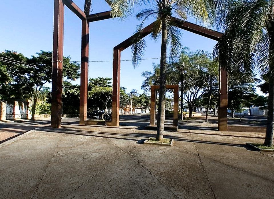
Brazil: Betim and Sorocaba launch Climate Risk Analysis and GHG Emissions Inventory
The Climate Risk Analysis and GHG Emissions are a part of the strategy to support climate action in the cities for the coming years Betim and […]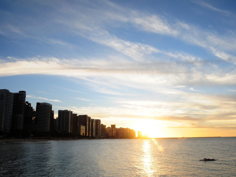
Fortaleza and Recife launch Local Action Plans with ambitious climate goals
The effects of climate change are experienced at the local level in urban areas. Events such as heavy rains that cause floods and landslides or an […]