Indonesia
Indonesia has committed to reduce its GHG emissions by 29% below the Business-As-Usual (BAU) scenario by 2030, and by an additional 12% by the same date if international support is forthcoming. The country is also committed to a mixed-energy use policy to bring renewables to 23% of total energy share by 2015. To this end, Indonesia is committed to capacity building at the local level, and enhanced urban waste and wastewater management policies, especially waste-to-energy processing. You can download Indonesia’s latest NDC here.
The Urban-LEDS project Phase I was implemented in Indonesia, where a total of eight cities participated. Two Model cities and six Satellite cities participated in the Urban-LEDS process and received support to create Low Emission Development Strategies, GHG inventories, climate commitments and implement a variety of low emission development solutions. Key achievements are outlined below. In Phase II of the Urban-LEDS project, participating cities will be supported in a review of the progress they have made towards low emission development, with a focus on developing project proposals and seeking funding to implement the action plans developed in Phase I. Where needed, data will be updated, including greenhouse gas inventories and climate change vulnerability risk assessments.
Led by: ICLEI Indonesia Program Office
Supported by: UN-Habitat Regional Office for Asia Pacific

About Indonesia
The low emission strategies developed by participating cities were aligned with a Presidential Regulation (No. 61 of 2011) that mandated implementation of emission reduction planning at the central, provisional, and local levels. Such regulations provide a basis for further policy dialogue on vertical integration.
At the same time, ICLEI Southeast Asia Secretariat is implementing the Rockefeller Foundation’s Asian Cities Climate Change Resilience Network (ACCCRN) in Indonesia. The ten cities being assisted through this initiative include the three Urban-LEDS cities of Bogor, Balikpapan, and Tangerang Selatan. This initiative offers an opportunity for support, with an emphasis on actions that yield both climate mitigation and adaptation benefits. Along those lines the country’s commitment to increased use of renewable energy offers encouragement to projects such as waste-to-energy processing.
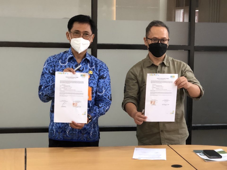
The Indonesian Project Advisory Group (PAG) was formed during a meeting in Bogor in July 2013, comprising representatives from the national government and other key stakeholders in the low emissions development field, to assist the Urban-LEDS cities and ensure alignment with national strategies. Most members of the original PAG no longer hold their position in their organizations and the group has been reestablished with new members in Phase II, creating the opportunity for synergy with a similar group foreseen in the Ambitious City Promises (ACP) and the 100% Renewable Energy Projects. To this end coordination with the national government has been made, in particular with the Urban, Housing, and Settlement Directorate, the Environmental Directorate of BAPPENAS (National Planning and Development Ministry), and with European Union representatives.
The PAG is envisioned to be a small multi-sectoral group comprised of ten to twenty individuals representing relevant government agencies and key development partners. Representatives of Urban-LEDS and ACP partner cities will be invited to be members of the PAG. Indonesia’s PAG is composed of representatives of Coordinating Ministry for Economy, Ministry of Environment and Forestry, Ministry of Planning & Development, Ministry of Energy & Mineral Resources, Ministry of Home Affairs, Ministry of Public Works & Housing, APEKSI (Association of Indonesia Municipalities), WWF Indonesia, SDSN Indonesia, Research Center on Climate Change University of Indonesia, European Commission, UN-Habitat, and the President’s Special Envoy for Climate Change.
Contact us
ICLEI Southeast Asia Secretariat
Units 3-4, Manila Observatory Ateneo de Manila University
Loyola Hts., Quezon City 1108, Philippines
Tel & Fax: +632 426 0851
E-mail: [email protected]
UN-HABITAT Regional Office for Asia and the Pacific
ACROS Fukuoka Building, 8th Floor
1-1-1 Tenjin, Chuo-ku
Fukuoka 810-0001, Japan
Tel: + 81 92 724 7121
Fax: +81 92 724 7124
E-mail: [email protected]
Website: http://www.fukuoka.unhabitat.org/
Results from Phase I
The national project launch took place in Bogor City in July 2013.
As Urban-LEDS Phase I finished, Indonesian cities had achieved the following:
- Bogor: In November 2014, the city adopted a Strategic Environmental Assessment (SEA) and the 5-Year Mid-Term Development Plan in Bogor (RPJMD2014-2019). The RPJMD is a mandatory document for the planning process which is undertaken by local governments in Indonesia, and it includes the City’s Low Emission Development Strategy. This is a vital document that determines the future direction of the city development, mandated by National Regulation. Both documents recognize climate change mitigation, adaptation, and disaster risk reduction as strategic priorities.
- Balikpapan: In August 2016 the City approved a Mitigation Action Plan, as part of the City’s 5-Year Mid-Term Development Plan for Balikpapan (RPJMD 2016-2020). The Action Plan reflects the city’s emission reduction target of 25% and includes robust guidelines for low-emission development, such as smart street lighting, energy efficiency in buildings, sustainable public transport, and waste management.
- All eight Indonesian cities have developed a GHG emissions inventory, and both model cities are reporting in the carbonn® Climate Registry (cCR). You can visit these registries in the city profile tabs below.
- All eight Indonesian cities have implemented a range of low-emission development solutions with the help of Urban-LEDS, including energy efficient lighting, low carbon waste management, green buildings, sustainable transport, fuel switch, and awareness raising. To read more about these solutions, download the final Urban-LEDS report or view the city profiles below.
- The project’s 2nd International Networking Seminar was hosted by the City of Bogor, from May 5-7, 2015.
Model cities
Balikpapan
Bogor
Satellite cities
Bontang
Kabupaten Bogor
Tanggerang Selatan (South Tangerang)
Tarakan
See tabs below for city profiles.
Balikpapan is a seaport city with an area of 503 km² on the East coast of Borneo in East Kalimantan. Balikpapan is known as a service city, making this area the tenth city of MICE (Meeting, Incentive, Conference, and Exhibition) in Indonesia. The city and its surrounding region are rich in resources and internationally known for their timber, mining, and petroleum export production. Balikpapan’s two harbors and airport are the main transportation hubs.
Balikpapan’s general topography consists of a contour area that is hilly (85%) with an altitude between 0 to 100 meters above sea level.
| Size of population (year) | 625,965 (2016) |
| Size (km²) | 503.33 km² |
| Population density (year) | 1243.65 hab/km² (2016) |
| Official language(s) | Bahasa |
| Major economic activities in the city | Primary sector: agriculture, mining, fishing. Secondary sector: industry, manufacturing. Tertiary: services. |
| Population growth trend | 1.66% |
| % of population living in urban areas | 52.09 % |
| Greenhouse Gas emissions (total in C02e/year) | 3,791,406 MtCO2e (2018) |
| City official website | Click here |
Greenhouse Gas emissions by sector
- AFOLU
- Waste
- Transportation
- Stationary Energy
| Source | Amount (tCO2e) | % |
|---|---|---|
| AFOLU | 6,294 | 0.2% |
| Waste | 171,275 | 4.5% |
| Transportation | 500,744 | 13.2% |
| Stationary Energy | 3,113,093 | 82.1% |
Bogor City is located in the southern Jakarta Metropolitan Area, West Java Province. Green sceneries populate the area due to a botanical garden located in the middle of the city. Consisting of 6 districts and 68 sub-districts, Bogor is considered a trade and tourist destination. Bogor is also a pioneer among secondary cities in Indonesia in terms of pursuing sustainable development initiatives. Bogor participated as model city in Phase I of Urban-LEDS.
The general topography of Bogor consists of both hilly and flat terrain with the Ciliwung River and Cisadane River cutting across the city.
| Size of population (year) | 1,081,099 (2017) |
| Size (km²) | 118.5 km² |
| Population density (year) | 9,122 hab/km² (2017) |
| Official language(s) | Indonesian |
| Major economic activities in the city | Tertiary sector: Wholesale, retail trading. Secondary sector: industry. |
| Population growth trend | 1.5% |
| % of population living in urban areas | 100% |
| Greenhouse Gas emissions (total in C02e/year) | 2,222,611 MtCO2e (2018) |
| City official website | Click here |
Greenhouse Gas emissions by sector
- AFOLU
- Waste
- Transportation
- Energy
| Source | Amount (tCO2e) | % |
|---|---|---|
| AFOLU | 5,455 | 0.2% |
| Waste | 179,718 | 8.1% |
| Transportation | 1,147,581 | 51.6% |
| Stationary Energy | 889,857 | 40.1% |
Bontang is a city on the eastern coast of the island of Borneo, in the province of East Kalimantan. The major development of Bontang took place after two major companies were founded there in the 1970s: PT Badak Liquid Natural Gas and PT Pupuk Kaltim. Bontang has a tropical rainforest climate with temperatures that are warm and relatively stable throughout the year. Rainfalls are frequent and abundant. Bontang also has a mangrove park as a popular tourist destination. Bontang participated as a satellite city in Phase I of Urban-LEDS.
The general topography of Bontang is hilly terrain located near an ocean estuary. It has little-to-no tectonic activity and is generally swampy and prone to flooding. A mangrove forest is situated within the town, while the Api-Api River provides the town with fresh water.
| Size of population (year) | 170,611 (2017) |
| Size (km²) | 497.57 km² |
| Population density (year) | 340 hab/km² (2017) |
| Official language(s) | Indonesian |
| Major economic activities in the city | Primary sector: processing industry (oil and gas) and manufacturing. In 2017, the sector contributed 83.95 percent towards Bontang City’s GDP. As one of the industrial cities for oil and gas processing, The Bontang City has a Local Owned Enterprises (BUMD) that manages mining, processing, oil and gas trade, and energy professionals in order to take advantage for development for the community and Bontang City Government.
Secondary sector: fishing and grass cultivation of seaweed To develop these industries, Bontang City Government plans to set up a processing plant for seaweed. Tertiary: services and tourism. Tourist hot spots include Wet Rice Island, Bontang Kuala, and Bontang City. |
| Population growth trend | 2,24% (2017) |
| % of population living in urban areas | – |
| Greenhouse Gas emissions (total in C02e/year) | Unavailable |
| City official website | Click here |
Bogor Regency (Indonesian: Kabupaten Bogor) is a regency (kabupaten) of West Java, Indonesia, located 40 km from DKI Jakarta province. It consists of 40 subdistricts, 19 subdistricts and 435 villages. Bogor Regency has a strategic location regarding natural resources, which is 41,064 Ha of conservation forest and is located at an upstream of 8 watersheds crossed by 33 rivers and 102 lakes. Mostly consisting of highlands, hills, and mountains, with numerous deltas, ponds, lakes, and water springs. The soil is mainly composed of volcanic rocks which have good water absorption capacity and is prone to landslides.
| Size of population (year) | 5,715,009 people (2017) |
| Size (km²) | 2,663.83 km² |
| Population density (year) | 2,146 hab/km² (2017) |
| Official language(s) | Indonesian, Sundanese, Betawi, and English |
| Major economic activities in the city | 54% of processing industry, 13% of motor and car reparation, 9% of construction, 5% of agriculture, fishing and forestry, 4% of transportation, 3% of mining extraction, 3% of accommodation and food, 2% of information and communication, 2% of education, 5% of others |
| Population growth trend | 2,20% (2018) |
| % of population living in urban areas | 79% (2010) |
| Greenhouse Gas emissions (total in C02e/year) | 5,310,139 tons of CO2e (2010) |
| City official website | Click here |
Greenhouse Gas emissions by sector
- Manufacturing Industries
- Residential
- Transport
- Aggregate emission sources and non CO2 emission sources
- Commercial and Institutional
- Livestock
| Source | Amount (tCO2e) | % |
|---|---|---|
| Manufacturing industries | 2,336,461 | 44% |
| Residential | 1,115,129 | 21% |
| Transport | 1,062,028 | 20% |
| Aggregate emission and non CO2 emission sources | 371,709 | 14% |
| Commercial and institutional | 212,405 | 4% |
| Livestock | 212,405 | 4% |
South Tangerang City is an autonomous region formed at the end of 2008 based on Law Number 51 Year 2008 concerning the Establishment of South Tangerang City in Banten Province. The formation of the new autonomous region was carried out with the aim of increasing the welfare of the community, public services and regional competitiveness. South Tangerang city was already involved in phase 1 as satellite city for Java region in which Bogor city as its model city.
South Tangerang City is located in the eastern part of Banten Province and has administration boundaries as follows:
- In the north is bordered by Tangerang City and DKI Jakarta Province.
- In the east side is bordered by DKI Jakarta Province and Depok City
- In the south side is bordered by Depok City and Bogor Regency
- In the west side is bordered by Tangerang Regency.
The highest growth was reached by transportation and warehousing category at 99.88%. Then followed by company service category at 9.32%, electricity, gas and water supply category at 9.15% and construction category at 9.12%. (source: South Tangerang city in number, 2019)
| Size of population (year) | 1,696,308 (2018) |
| Size (km²) | 147.19 km² |
| Population density (year) | 11,524 hab/km2 |
| Official language(s) | Indonesian |
| Major economic activities in the city | Primary sector: services, trade, tourism, real estate. Secondary sector: telecommunications and transportation. Tertiary: farming and mining. |
| Population growth trend | 2017-2018: 3.13% |
| % of population living in urban areas | 100% (2010) |
| Greenhouse Gas emissions (total in C02e/year) | Unavailable |
| City official website | Click here |
Tarakan is the largest city of the Indonesian province of North Kalimantan. The island of Tarakan is located in northern Borneo, just across the border from Sabah, Malaysia. It is the sole city within the newly established province of North Kalimantan. Tarakan participated as a satellite city in Phase I of Urban-LEDS.
Located on a large island off the coast of northern Borneo. It is dominated by lowlands with various beaches and tidal swamps. Tarakan also has alluvial plains and mangroves that grow in abundance within the city’s tidal swamps. The characteristic of terrain in Tarakan City is quite hilly in parts of the city located in the center of the island. Like all Indonesian cities, Tarakan has a tropical climate.
| Size of population (year) | 244,211 (2018) |
| Size (km²) | 250.80 km² |
| Population density (year) | 973.62 hab/km² (2018) |
| Official language(s) | Indonesian and Tidungese |
| Major economic activities in the city | Primary sector: trading, industry, and manufacturing. Secondary sector: fishery and forestry. Tertiary: oil and mining. |
| Population growth trend | 3,66% (2015-2016) |
| % of population living in urban areas | 92.5% (2010) |
| Greenhouse Gas emissions (total in C02e/year) | 211,543.40 Gg CO2e (2018) |
| City official website | Click here |
Greenhouse Gas emissions by sector
- Energy
- Agriculture
| Source | Amount (tCO2e) | % |
|---|---|---|
| Energy | 199,732.66 | 94.4% |
| IPPU | 5.59 | – |
| Agriculture | 11,809.72 | 5.6% |
| Waste | 13.44 | – |
| Forestry | -18.00 | N/A |
News from the country
Bogor City puts up community-scale waste management pilot project using hydro-pyrolysis technology
The Urban-LEDS II Project supported Bogor City in managing municipal solid waste at the community level through hydro-pyrolysis technology. This technology aims to reduce greenhouse gases—particularly methane gas—generated by the waste sector, […]
Bogor City uses domestic waste to generate clean energy for cooking
Through the Urban-LEDS II Project in collaboration with the ICLEI Indonesia Office, the City Government of Bogor continues to support Indonesia in the country’s drive to […]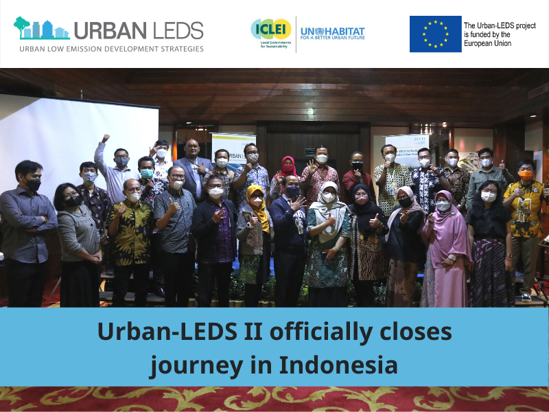
Urban-LEDS II officially ends in Indonesia
After 4.5-years, Urban-LEDS II project (Urban Low Emission Development Strategies II) in Indonesia ended on 28 October 2021. The Final Closing Workshop was organized by the […]
Balikpapan City Accelerates Low Emission Development through a Pilot Project on Methane Gas Capture
The Urban-LEDS II Indonesia model city of Balikpapan steps up its efforts to reduce greenhouse gas emissions by completing a small-scale pilot project that utilizes landfill-emitted […]