Colombia
Colombia’s Nationally Determined Contributions (NDC) target is to reduce GHG emissions by 20% below the Business As Usual (BAU) sccenario by 2030; this reduction could rise to 30% below BAU if international support is available. In late 2016, a member of the Colombian delegation to COP22 expressed support for the vertical integration of city-level reporting into consolidated national-level NDC reporting for the 10-15 largest cities.
Colombia is implementing an innovative, urban-sector Nationally Appropriate Mitigation Action that is relevant to Urban-LEDS. This NAMA promotes compact, transit-oriented development in several cities as a way to reduce transportation sector emissions – a potential financing model to explore for replication in other cities and countries via South-South learning. Two statutory plans provide opportunities for mainstreaming climate action: land use plans (planes de ordenamiento territorial) completed every twelve years and municipal development plans that correspond to mayors’ four year mandates. The cities participating in the project receive support to develop Low Emission Development Strategies, GHG emission inventories, climate commitments, and implement a variety of low emission development solutions – see page At a Glance and Achievements.
Led by: ICLEI South America Secretariat.
Supported by: UN-Habitat Regional Office for Latin America and the Caribbean

Contact us
ICLEI South America Secretariat
Based in the metropolitan area of the Aburrá Valley
Carrera 53 N 40A-31
Medellín, Antioquia – Colombia.
E-mail: [email protected]
UN-Habitat Regional Office for Latin America and the Caribbean
Rua Rumania 20 Rio de Janeiro RJ CEP 22240-140
Tel: +55 21 3235 8550
E-mail: [email protected]
| Size of population (year) | 45,500,000 (2018) |
| Size (km²) | 1,138,914 |
| Population density (year) | 43,33/ km2 (2018) |
| Official language(s) | Spanish |
| Time Zone | -5:00 GMT |
| GDP per capita | 377,623 |
| Annual GDP Growth rate | 1,8% |
| % of population living in poverty | 17% ( DNP) |
| Unemployment rate | 10.2 % |
| Link to updated NDC | Click here |
Greenhouse Gas emissions by sector
- Energy
- Agriculture
- Forestry
- Waste
- Others
| Source | % |
|---|---|
| Energy | 27,9% |
| Agriculture | 36,6% |
| Forestry | 13,3% |
| Waste | 5% |
| Others | 17,2% |
Cities
Envigado
Manizales
Ibague
Cartago
Santiago de Cali
The Metropolitan Area of the Aburrá Valley
Tópaga
Valledupar
See tabs below for city profiles.
Envigado is a municipality in Colombia located in the south of the Aburrá Valley in the department of Antioquia and near the city of Medellín.
Envigado was not involved in phase 1 of Urban-LEDS
| Size of population (year) | 242.197 inhabitants (TerriData 2020) |
| Size (km²) | Urban area: 12,12 km2(15%), Rural area: 66,68 km2(85%) Total area: 78 km2 |
| Population density (year) | 4.749 inhabitants per square kilometer (TerriData 2020) |
| Official language(s) | Spanish |
| Major economic activities in the city | Primary sector: agriculture. Secondary sector: industry and manufacturing (food, textiles, printing and publishing, metal industry, chemicals, construction, machinery and equipment. Tertiary: services (trade, communications, and financial establishments) |
| Population growth trend | 2,32% per year (Ficha de caracterización del municipio de Envigado, Departamento Nacional de Planeación (2017)) |
| % of population living in urban areas | Urban areas 234.143 (96,7%), Rural areas 8.054 (3,3%)
(DANE projections) |
| Average annual rate of urbanization | 80%, 2018 |
| Greenhouse Gas emissions (total in C02e/year) | 246.459 ton Co2 eq / year (2018) |
| City official website | Click here |
Greenhouse Gas emissions by sector
- Energy
- Transport
- Waste
- IPPU
- AFOLU
| Source | Amount (tCO2e) | % |
|---|---|---|
| Energy | 127,051 | 52% |
| Transport | 69,439 | 28% |
| Waste | 29,293 | 12% |
| IPPU | 17,132 | 7% |
| AFOLU | 3,540 | 1% |
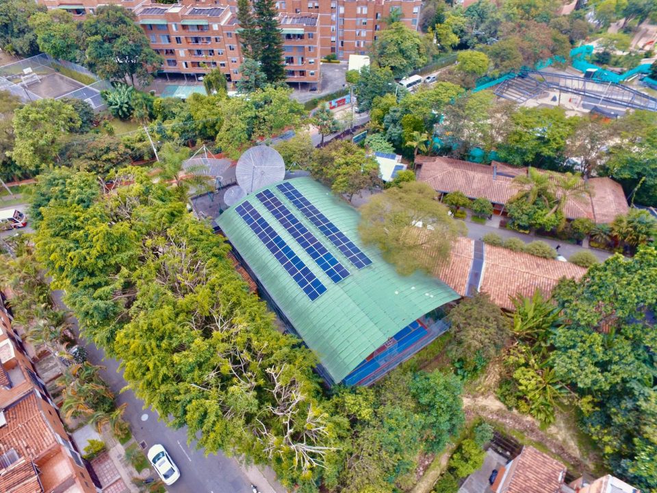
Manizales is a Colombian municipality, founded in 1849. It is a city with economic, industrial, cultural, and tourist activities. Cultural activities include the Manizales Fair, and the International Theater Festival of Manizales, part of its rich history as the Theater City of Colombia.
The city of Manizales, located at a height of 2,153 meters above sea level, is located in the central region of western Colombia, on the extension of the Andes mountain range. Due to its geographical location, in Manizales there are 8 microclimates with diverse landscapes, such as snow-capped mountains, volcanoes, forests, mountains, and valleys, and an average temperature of 16°C. Towards the west, there is the Cauca River Valley, which allows warm climates suitable for coffee cultivation. Towards the east and the south, the paramos appear along with the snowy landscape of Los Nevados Natural National Park.
| Size of population (year) | 446,160 (DANE projections to 2020) |
| Size (km²) | Rural area: 380.12 km², urban Area: 191.76 km², total area: 571.8 km² |
| Population density (year) | 830.35 hab/km² (Municipal Development Plan 2016-2020) |
| Official language(s) | Spanish |
| Major economic activities in the city | According to GDP, the economic sectors are concentrated in the following branches: Industry: 21%, housing renting: 14%, Financial sector: 14% (Municipal Development Plan 2016-2020) |
| Population growth trend | 0.35% per year |
| % of population living in urban areas | Urban areas 375.432 (93.75%), Rural areas 25.004 (6,25%)
(DANE projections to 2020) |
| Average annual rate of urbanization | 74% (2018) |
| Greenhouse Gas emissions (total in C02e/year) | 384.256 ton CO2e in 2018 |
| City official website | Click here |
Greenhouse Gas emissions by sector
- Energy
- Transport
- Waste
- IPPU
- AFOLU
| Source | Amount (tCO2e) | % |
|---|---|---|
| Energy | 145,412 | 36.48% |
| Transport | 132,590 | 33.26% |
| Waste | 71,024 | 17.82% |
| IPPU | 32,521 | 8.15% |
| AFOLU | 17,015 | 4.26% |

Ibagué is a Colombian municipality located in the center-west of Colombia, on the Central Mountain Range of the Andes. It is the capital of the department of Tolima.
The municipality of Ibagué is located on the eastern slope of the central mountain range of Colombia, at the source of a wide valley formed by the Coello River and its tributary the Combeima River. These rivers takes its waters from the snowy peaks of the Nevado del Tolima and are part of the Los Nevados National Park of Colombia, which largely belongs to the Municipality of Ibagué.
| Size of population (year) | 529,635 (City Development Plan 2020-2023) |
| Size (km²) | 1,439 km (City Development Plan 2020-2023) |
| Population density (year) | 386,06 hab/km (City Development Plan 2020-2023) |
| Official language(s) | Spanish |
| Major economic activities in the city | The sectors of the economy of Ibagué are classified as follows: 83.9% corresponds to the tertiary sector, 14.5% to the secondary sector and only 1.5% to the primary sector. The capital of Tolima, Ibagué, concentrates 37% of the population and concentrates most of the administrative, institutional, financial, commercial, and industry services provision. (City Development Plan 2016-2020) |
| Population growth trend | 0,94% (2017) |
| % of population living in urban areas | Urban areas 501.991 (92,77%), Rural areas 39.110 (7,23%)
(DANE projections to 2018) |
| Average annual rate of urbanization | 72% (2018) |
| Greenhouse Gas emissions (total in C02e/year) | 819,318 t CO2e in 2014. The results of the inventory of GHG emissions indicate the balance of GHG emissions per capita of the municipality of Ibagué, which amounts to 1.49 t CO2. The emissions of the municipality of Ibagué in 2014 were 1,229,249 t CO2e. Part of these emissions are offset by the absorptions, which amount in the same year to 409,931 t CO2e, resulting in an emissions balance of 819,318 t CO2e. |
| City official website | Click here |
Greenhouse Gas emissions by sector
- AFOLU
- Mobility
- Stationary sources
- Residential
- Waste
| Source | Amount (tCO2e) | % |
|---|---|---|
| AFOLU | 440,052 | 33% |
| Mobility | 397,946 | 32% |
| Stationary sources | 231,853 | 19% |
| Residential | 109,349 | 9% |
| Waste | 91,593 | 7% |

Cartago is a Colombian municipality located to the north of the department of Valle del Cauca, which is located on the banks of the La Vieja River and west of the Cauca River. It is one of the oldest populations of the Department of Valle del Cauca, Colombia, and South America.
The municipality is located in the north of the department of Valle del Cauca, being the gateway to this area, and is also located in the Cordillera Central belonging to the Andean Region of Colombia. It is located in a plain at a height of about 917 meters above sea level. Through the municipality, the Cauca river passes by one side and the La Vieja river runs parallel to the city. La Vieja river also represents a natural border with the department of Risaralda and is a main transport channel for the city. The territory is flat and slightly undulating.
| Size of population (year) | 135,621 (DANE Projections 2018 – 2020) |
| Size (km²) | 279 (City Hall Cartago, 2020) |
| Population density (year) | 464 hab/km² (Municipal Development Plan 2016-2019) |
| Official language(s) | Spanish |
| Major economic activities in the city | The economic activities of Cartago are mainly agriculture, livestock, commerce and small industry in which needlework stands out. Its colonial architecture represented in the religious temples and its spas make it attractive to tourists. The economic activities related to embroidery are well known, for this reason it is known to the city as the “Needlework Capital of the World” (Municipal Development Plan 2016-2019) |
| Population growth trend | Not available data |
| % of population living in urban areas | Urban areas 1,32,423 (98,5%), rural areas 1,886 (1,4%) (DANE projections to 2018) |
| Average annual rate of urbanization | 44% (2018) |
| Greenhouse Gas emissions (total in C02e/year) | Not available data |
| City official website | Click here |

Cali is the official Special, Sports, Cultural, Tourism, Business, and Services District of Santiago de Cali, capital of the department of Valle del Cauca. Cali is the third most populated city in Colombia. It is located in the southern region of the Cauca Valley, between the western mountain range and the central mountain range of the Andean region. The city is part of the metropolitan area of Cali, along with the municipalities close to it.
The city is flat with an average elevation of 1,000 meters above sea level. Cali is also located in a strategic point: connecting with the port of Buenaventura on the Pacific coast (approximately 100 km) towards the west, and the industrial center of Yumbo to the northeast. The Pan-American Highway crosses the city, making the city a compulsory passage from Colombia to Ecuador, with the Cauca River, also running through.
| Size of population (year) | 2,469,442 (Department of Planning, 2019) |
| Size (km²) | Urban area: 119.2 km²; Rural area: 426.1 km²; Expansion area: 16,3 km²
(Department of Planning, 2018 – 2019) |
| Population density (year) | 4456 hab/km² (Department of Planning, 2018 – 2019) |
| Official language(s) | Spanish |
| Major economic activities in the city | Cali has been characterized by developing an economic dynamic focused on commercial activities and service offerings. It has experienced in recent years a shift towards the manufacturing industry, peculiarity of neighbouring municipalities such as Yumbo, Palmira, Candelaria, Jamundí, even the North of Cauca). The past mining-energy boom that boosted the country’s economy did not mark the economic growth of the department of Valle del Cauca, or its capital city in the same way, this activity does not have a strong impact on the Valle del Cauca economy. |
| Population growth trend | The city has grown by 39,7% since 1991 (Cali en cifras 2018-2019) |
| % of population living in urban areas | Urban areas 2020: 2.459.789 (98,53%), Rural areas 2020: 36.653 (1,46%)
(Cali en cifras 2018-2019) |
| Average annual rate of urbanization | 44% (2018) |
| Greenhouse Gas emissions (total in C02e/year) | 4,174,608 tons of CO2e (2010) |
| City official website | Click here |
Greenhouse Gas emissions by sector
- Energy
- Wate
- Other
| Source | Amount (tCO2e) | % |
|---|---|---|
| Energy | 2,900,000 | 71% |
| Waste | 1,100,000 | 27.4% |
| Other | 174,608 | 1.6% |

The Metropolitan Area of the Aburrá Valley is made up of 10 municipalities: Medellín (as a core city), Envigado, Barbosa, Copacabana, Caldas, Itagui, Bello, Girardota, Sabaneta and La Estrella.
The topography of the Aburrá Valley is very hilly, with the Medellín River cutting across the city from north to south.
| Size of population (year) | 4,055,296 (DANE, 2020) |
| Size (km²) | Urban area: 340 km², rural area: 812 km², total area: 1,152 km² |
| Population density (year) | 3,520 hab/km² |
| Official language(s) | Spanish |
| Major economic activities in the city | Primary sector: commerce (43,84%) and services 32,84%). Secondary sector: industry (15,06%) and construction (2,80%). Tertiary: agriculture (1,19 %), mining (0,24%) and other (4,02%) (Cámara de Comercio de Medellín y Cámara de Comercio del Aburrá Sur. Cálculos: ECU y CP, 2011) |
| Population growth trend | 13% in the last decade |
| % of population living in urban areas | 95,1% (DANE, 2020) |
| Average annual rate of urbanization | 80% (2018) |
| Greenhouse Gas emissions (total in C02e/year) | 7.080.948 tCO2eq / 2015 |
| City official website | Click here |
Greenhouse Gas emissions by sector
- Waste
- Energy
- Transport
| Source | Amount (tCO2e) | % |
|---|---|---|
| Waste | 1,553,302 | 22% |
| Energy | 2,782.886 | 39% |
| Transport | 2,744,761 | 39% |

The Municipality of Tópaga is located in Department of Boyacá, 98 km. northeast of the departmental capital (Tunja). Its topography is part of the eastern mountain range.
The climate of Tópaga is dictated by cold weather and high mountains. It is located on the Eastern mountain range of the Colombian Andes.
| Size of population (year) | 3,697 (DANE projections to 2020) |
| Size (km²) | The total area of the municipality is 36 km². Urban area is 6,4 km² (17,29%), rural area is 30,6 km² (82,10%) (Topaga Municipal Development Plan 2016-2019) |
| Population density (year) | 112 hab/km² (Topaga Municipal Development Plan 2016-2019) |
| Official language(s) | Spanish |
| Major economic activities in the city | The economy of the Municipality of Tópaga has its bases in the primary sector, where agriculture, mining and livestock stand out. Coal mining is an economic activity on which a large part of the population depends.
It’s the third producer of thermal coal in the region. Also, it is important its artisanal activity in the charcoal carving by the Coal Carvers Foundation of the municipality of Tópaga. The tertiary or service sector is based mainly on trade and tourism. (Topaga Municipal Development Plan 2020-2023). |
| Population growth trend | -0,1% per year (Ficha de caracterización del municipio de Envigado, Departamento Nacional de Planeación (2017)) |
| % of population living in urban areas | Urban areas: 1.091 (29,5%), Rural areas 2.606 (70,5%) (DANE projections to 2018) |
| Average annual rate of urbanization | 58% (2018) |
| Greenhouse Gas emissions (total in C02e/year) | 18,637.2 CO2e /2018 |
| City official website | Click here |
Greenhouse Gas emissions by sector
- Energy
- Transport
- Waste
- AFOLU
| Source | Amount (tCO2e) | % |
|---|---|---|
| Energy | 9,344.4 | 50.14% |
| Transport | 476.8 | 2.55% |
| Waste | 626.8 | 3.36% |
| IPPU | 8,189.2 | 44.1% |

Valledupar is the capital of the department of Cesar, Colombia. It is located north of the Cesar Valley, between the Sierra Nevada de Santa Marta and the Serranía del Perijá, on the margin of the Cesar and Guatapurí rivers, on the Colombian Caribbean Coast.
The city is an important center for agricultural, agro-industrial and livestock production in the region between the north of the Cesar department and the south of the La Guajira department. It is also one of the main musical, cultural and folkloric epicenters of Colombia as it is the cradle of vallenato, the most popular musical genre in the country and currently a symbol of Colombian music.
| Size of population (year) | 532,956 (TerriData, 2020) |
| Size (km²) | 4,493 |
| Population density (year) | 126 inhabitants per Km² (TerriData, 2020) |
| Official language(s) | Spanish |
| Major economic activities in the city | The municipal economy revolves around the livestock sector. Livestock is extensive. The Cesar cattle ranch is the result of the crossing of Creole types with the zebu. The region is a producer of meat and milk. Other important agricultural products are cotton and rice.
In the tertiary sector, stands out the installation of a growing list of companies dedicated to providing health services, telecommunications and banking services. |
| Population growth trend | +2.19% per year (City Development Plan 2020-2023) |
| % of population living in urban areas | Urban areas: 468.165 (87,8%)
Rural areas 64.791 (12,2%) |
| Average annual rate of urbanization | 78%, 2018 |
| Greenhouse Gas emissions (total in C02e/year) | 1.326.253 tonCO2e (2013) (Valledupar 2030 Action Plan) |
| City official website | Click here |
Greenhouse Gas emissions by sector
- AFOLU
- Transport
- Waste
- Stationary Energy
| Source | Amount (tCO2e) | % |
|---|---|---|
| AFOLU | 649,864 | 49% |
| Transport | 371,351 | 28% |
| Waste | 106,100 | 8% |
| Stationary Energy | 198,938 | 15% |
News from the country
LEDS Lab closes in Colombia with projects installed in Topaga and Envigado
The climate crisis that planet earth is facing today requires concrete, constant and coherent actions. The rapid and accelerated way in which climate change is affecting […]
Colombia advances in the integration of climate change into National Urban Policies, with technical assistance from Urban-LEDS and UN-Habitat’s guiding frameworks
Colombia is moving forward in the integration of climate change priorities into their new National Urban Policy, with a special focus on enhancing multi-level governance structures […]
LEDS Lab ends cycle in Brazil and Colombia
The results of LEDS Lab were summarized in a Guide to Developing Bankable Climate Action Projects To help improve the installed capacity of city halls in […]
Colombian cities advance in local climate action
A series of webinars was held from June to August 2020 aiming at supporting local actions for Greenhouse Gas (GHG) emission reduction and adaptation to climate […]